

Orinav: Navigation App for People with Visual Impairments
Initiated in 2024 by a student team at Beijing Academy International Division, Orinav is an accessibility technology project designed to support independent outdoor travel for people with visual impairments. The project brings route navigation and environmental recognition into a single mobile application, offering features including route planning, clock face orientation, obstacle recognition, crossing assistance, traffic light recognition, and object recognition. Its interface and feedback system are also designed specifically for people who use screen readers. While walking, users can receive continuous route guidance and use their phones to learn about obstacles, traffic signals, tactile paving, and other features of the surrounding environment.
From the earliest Beacon prototype to BeaconNext and the present version of Orinav, the team has continued to develop the project around the needs of people with visual impairments in real street environments. The team has conducted literature research and user interviews, developed the software, and carried out a field study on real roads. The project has also received long term guidance from researchers in accessibility development at Tsinghua University. Orinav is now available on both iOS and Android and has served more than 700 users across China, the Netherlands, the United Kingdom, Egypt, and the United States.
Project Background and Motivation
The team's interest in accessibility began with observations and conversations outside the project itself. In 2023, team members encountered accessible traffic signals designed for people with visual impairments in Japan, which led them to pay closer attention to differences in accessible travel facilities across cities. During the summer of 2024, while tutoring a blind high school student in English over an extended period, the team learned more about the difficulties that people with visual impairments encounter in education, employment, and everyday travel. Being able to reach schools, workplaces, and public spaces independently is an important part of participating in society, which led the team to focus on outdoor navigation.
Common mobility tools for people with visual impairments include white canes, guide dogs, and mobile navigation applications. A white cane can help a user understand nearby ground level conditions, while a navigation application can plan routes and announce turns. Walking through a real street environment also requires continuous awareness of body orientation, obstacles ahead, crossing locations, and traffic signals. Sighted pedestrians usually obtain much of this information visually. People with visual impairments often need to combine information from different tools with their own auditory and spatial judgment.
To understand these problems more systematically, the team reviewed research on navigation and electronic travel aids for people with visual impairments and compared existing technical approaches. Studies by Real and Araujo divide assistive navigation into macro navigation and micro navigation. Macro navigation covers positioning, route planning, and directional guidance, while micro navigation focuses on obstacles, roads, and the surrounding environment. The team also examined representative projects including SUBE, CyARM, DeepNAVI, Tyflos, Drishti, TARSIUS, and ENVISION. Many systems concentrate on one side of the navigation process, while systems that cover both often depend on dedicated wearable devices, Bluetooth tags, external cameras, or infrastructure installed in advance.
Alongside the literature review, the team continued interviewing people with visual impairments. Early research included several in depth interviews, followed by a broader series of open conversations and discussions with accessibility professionals. Users raised highly specific concerns. A navigation application might bring someone close to a building while still leaving the actual entrance difficult to locate. A simple left or right instruction may give little guidance about the final body orientation at an irregular intersection. Traffic light recognition can also depend heavily on camera direction and lighting, while long spoken instructions may interfere with the environmental sounds that users rely on to understand surrounding traffic.
These interviews gradually established the project's main design priorities. Orinav needed to combine route navigation and environmental recognition on one phone, reducing the need to switch between applications while walking. Navigation instructions needed to remain concise, while urgent information required higher priority. Directional guidance also needed to follow expressions already familiar to many people with visual impairments. Environmental information could then be communicated through speech, sound, and haptic feedback according to distance and context. Throughout development, the team has continued to focus on safety, cost, ease of use, and travel efficiency.
From Beacon to Orinav
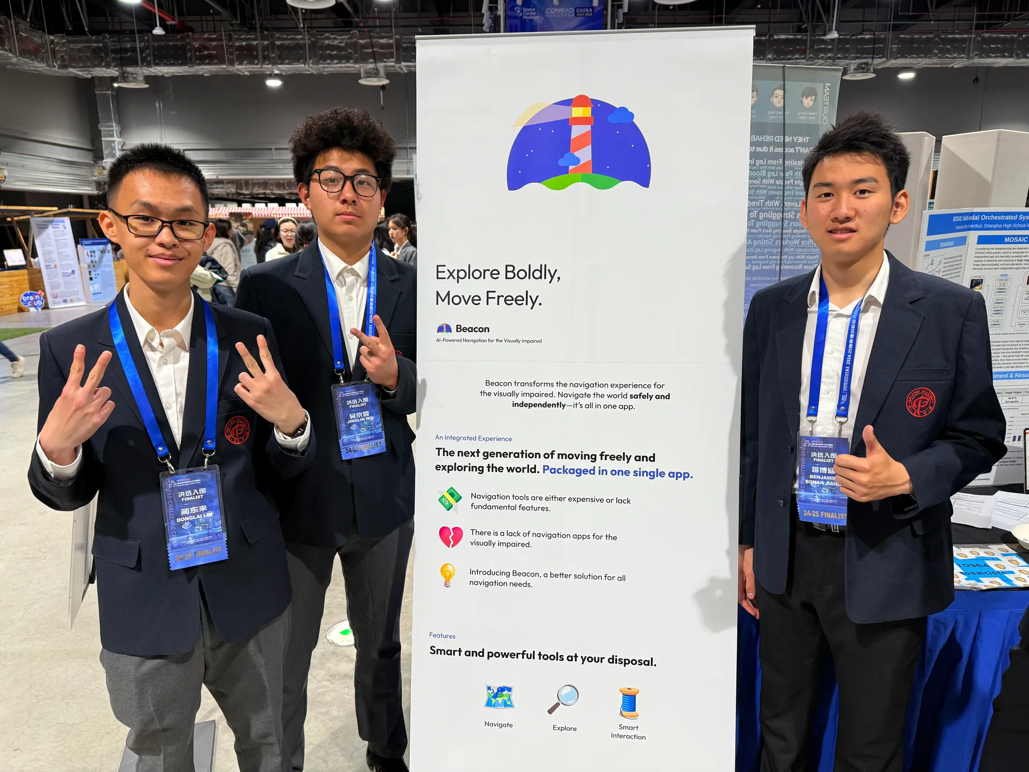
The earliest prototype of Orinav was called Beacon. In the fall of 2024, the team began exploring how route navigation, obstacle recognition, and traffic signal recognition could operate within the same mobile application, and entered the prototype in the Conrad Challenge. This early version helped establish the project's overall direction while revealing problems in map navigation, recognition accuracy, and software architecture. As more functions were added, the original codebase became increasingly difficult to extend, and several recognition functions required further improvement in complex street environments.
In the spring of 2025, after an important prototype demonstration exposed these problems more clearly, the team decided to rebuild the core system. In April, the project restarted under the name BeaconNext with guidance from accessibility researchers at Tsinghua University. The team reorganized the software architecture, integrated mapping services including Mapbox, revised the navigation logic and accessible interface, and redesigned the way environmental recognition functions worked together. As the system matured, the project adopted its current name, Orinav, and began expanding its user evaluations and field research.
This redevelopment also changed the way the team approached individual functions. Traffic light recognition works more effectively when the system already knows that the user is approaching a crossing. Obstacle alerts need to respond quickly to real distance information, while orientation guidance depends on both the user's current heading and the direction of the next road segment. Orinav therefore adopted a modular architecture in which macro navigation, micro navigation, and information output work together according to the user's location and current stage of the journey.
User feedback has remained part of the development process throughout the project. The team adjusted instruction frequency, directional language, and haptic feedback according to the habits of people with visual impairments, while continuing to add new types of road information. After multiple rounds of development, Orinav gradually progressed from an early competition prototype to a publicly available application that continues to evolve according to problems encountered on real streets.
Core Functions and Technical Design
Route Navigation and Directional Guidance
Orinav's macro navigation system handles destination search, route planning, and continuous walking guidance. In mainland China, the application uses mapping services including Tencent Maps, while international versions use services including Mapbox. Because conventional interactive maps can be difficult to operate with a screen reader, Orinav uses a more direct text and speech interface by default. It continuously communicates the user's location, remaining distance, and next action, reducing dependence on a visual map.
User interviews showed that people with visual impairments can miss a navigation instruction while listening to traffic and other environmental sounds. Orinav therefore repeats key instructions more frequently. In the research version, the default interval was approximately 10 meters, and users could adjust this interval themselves. Repeated instructions became shorter and retained only the action required at that moment. Users could also shake the phone to hear their current location and navigation instruction again. Later versions added step based guidance and voice search, allowing users to hear how many steps remain before the next action.
Directional orientation became one of Orinav's distinctive early features. Conventional navigation applications generally describe directions using left and right turns, which may provide limited information at irregular intersections. Based on user interviews and related research, the team adopted clock face directions. The user's current heading is assigned to 12 o'clock, and the system calculates the target road's relative position. When the target lies about 90 degrees to the user's right, for example, the system can instruct the user to face 3 o'clock. As the user changes direction, the application continues updating the orientation and indicates when alignment has been reached.
Obstacle and Environmental Recognition
Orinav's micro navigation system provides information about the road and surrounding environment. When the user raises the phone, the application activates the rear camera and, on supported devices, reads depth information from LiDAR or infrared sensors. In the research version, the system selected an adjustable region in the center of the camera view and used depth data from this area to estimate the distance of obstacles ahead. To reduce errors caused by abnormal depth readings, the algorithm used the fifth percentile of depth values as its main reference.
When an obstacle comes within approximately 2 meters, the system provides different levels of sound and haptic feedback according to distance. Alerts become stronger as the obstacle approaches. The team chose this method because obstacle information requires rapid feedback, while longer spoken messages can delay the user's response. The current version also includes alerts for areas with dense obstacles, giving users advance information about the general condition of the path ahead.
Orinav can also recognize common objects in the surrounding environment. The research version used a YOLOv8 model pretrained on the COCO dataset and ordered announcements according to the size of recognized objects in the camera view. By default, the system announced the 3 largest objects, while users could adjust the number themselves. Obstacle alerts mainly communicate how close something is, while object recognition provides additional information about what is nearby.
Crossing Assistance and Traffic Light Recognition
Crossing streets is one of the more complex parts of outdoor navigation for people with visual impairments. Orinav combines the current route with OpenStreetMap road data to determine when a user is approaching a crossing, then prompts the user to raise the phone for traffic signal recognition. This allows traffic light recognition to activate at the point when crossing information is relevant, reducing the need to keep the camera active throughout the journey.
During the research stage, traffic light recognition used a LytNet neural network trained on the ImVisible dataset. Project records showed a precision of 0.98 and recall of 0.96 for red light recognition, while green light recognition achieved a precision of 0.95 and the same recall of 0.96. The team also added route information and additional verification to crossing detection, improving reliability on real streets.
Later user feedback introduced further requests, including traffic light orientation and tactile paving recognition. The team continued updating the Explore environmental recognition mode according to these suggestions. The current public version already includes tactile paving recognition and continues to expand crossing, signal, and road information. Entrance recognition has also become an important direction for future development, addressing the final part of a journey when a user reaches a building but still needs to locate the exact entrance.
Accessible Interaction Design
From the earliest stages of development, Orinav's interface was designed for screen readers such as VoiceOver. The application reduces dependence on interactive maps and complex visual controls, presenting route steps and status information in text structures that are easier for screen readers to navigate. The current product also continues to support screen readers such as TalkBack, allowing users across different platforms to search for destinations and operate navigation features.
The system uses speech, sound, and haptic feedback according to the type and urgency of information. Route instructions rely mainly on spoken guidance, while nearby obstacles use sound and haptic alerts. More urgent environmental information receives higher priority than ordinary route announcements. Macro navigation continues running in the background, while raising the phone activates micro navigation and selects functions such as obstacle recognition or crossing assistance according to the current situation.
Field Study on Real Streets
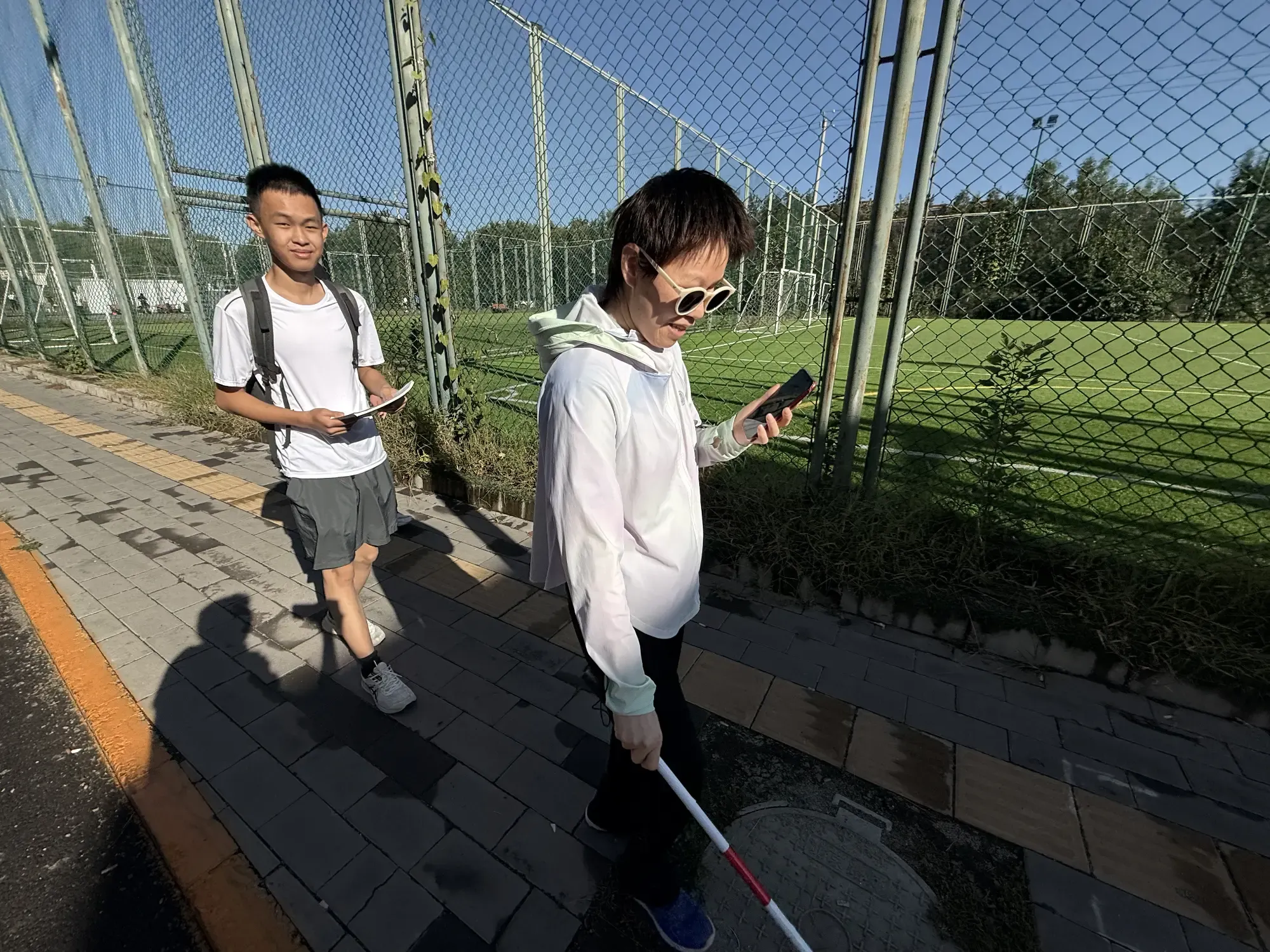
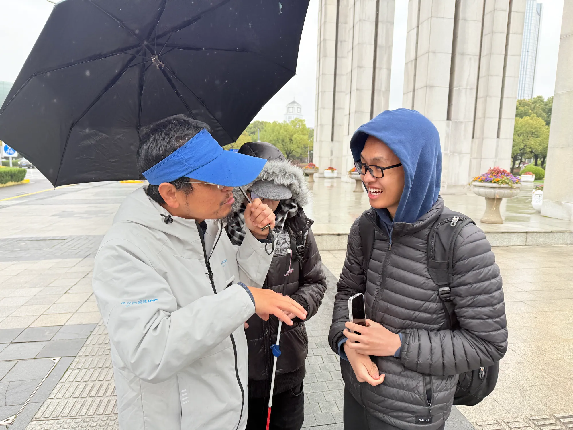
To evaluate Orinav during real outdoor travel, the team conducted a field study in Dongba, Beijing, in February 2026. The study completed the school's relevant ethics review process and included 18 adults with visual impairments between the ages of 28 and 54. All participants could use a white cane and a mobile screen reader. Each participant provided informed consent after receiving an explanation of the study and received compensation for participation.
The study compared Orinav with two other navigation conditions. Participants used Orinav with a white cane, Amap's accessibility mode with a white cane, and a white cane alone. Each participant completed 3 similar outdoor routes of approximately 200 meters. Every route contained one turn and one signalized crossing. A Latin square design was used to vary the order of conditions and reduce the influence of route familiarity. Before the formal evaluation began, participants received 15 minutes to become familiar with the phone, VoiceOver, Orinav, and Amap.
The study recorded completion time, hesitations, significant route deviations, and perceived usability. A pause longer than 3 seconds was recorded as a hesitation, while a deviation of more than 2 meters from the planned route was recorded as a significant deviation. The team also logged the actual use of orientation guidance and environmental recognition features. After completing the Orinav and Amap conditions, participants filled in the System Usability Scale and answered open ended questions about the functions they preferred and the improvements they hoped to see.
The results showed a clear difference in completion time. Participants using Orinav completed the routes in an average of 297.48 seconds, compared with 339.34 seconds when using Amap's accessibility mode. Orinav reduced the average completion time by 41.87 seconds, or approximately 12 percent, with a statistically significant difference. The average completion time using only a white cane was 367.64 seconds, giving Orinav an average reduction of 70.17 seconds relative to that condition.
Hesitations showed a similar pattern. Participants averaged 3.72 hesitations while using Orinav. Compared with Amap, Orinav reduced hesitations by an average of 2.94, while the reduction relative to the white cane condition was 2.39. Both differences were statistically significant. Public project materials later summarized this result as an approximately 44 percent reduction in hesitations. For significant route deviations, the Orinav condition averaged 1.22, with no statistically significant difference across conditions. Participants therefore completed routes more quickly while maintaining a similar level of route deviation.
Orinav also received a mean System Usability Scale score of 85, compared with 42.92 for Amap's accessibility mode, producing an average difference of 42.08 points. Participants frequently responded positively to clock face orientation, screen reader accessibility, and automatic function switching. They also requested tactile paving recognition, traffic light orientation, and entrance guidance. Some of these suggestions have since been added to the public version, while others remain part of continuing development.
Project Development and Social Impact
In September 2025, the public version of Orinav became available on the iOS App Store. During its first month, the application gained 334 users across China, the Netherlands, the United Kingdom, Egypt, and the United States. As development continued, the user community expanded beyond 700 people. The project later reached Android as well, allowing a broader group of users to participate in real world use and provide feedback.
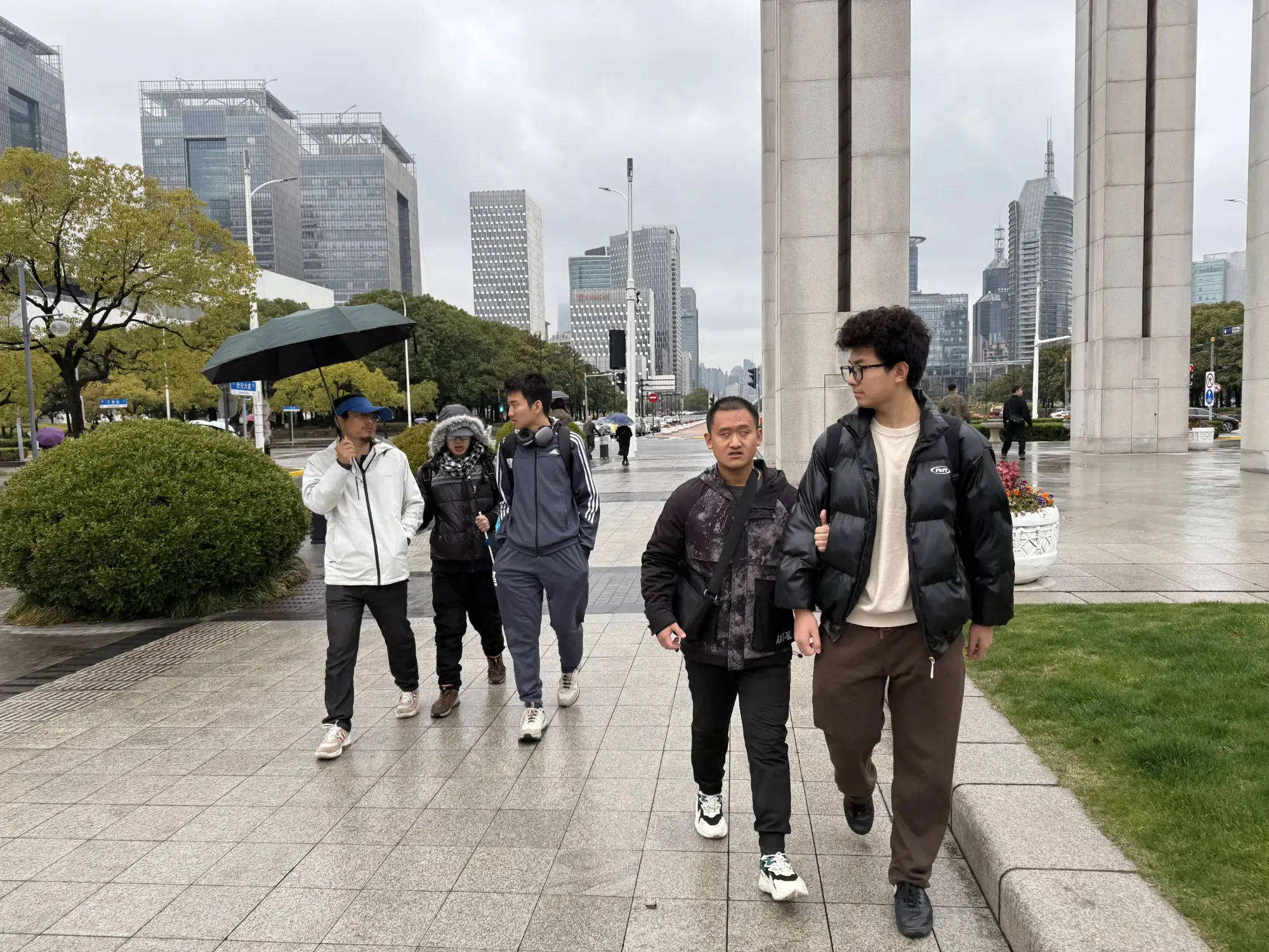
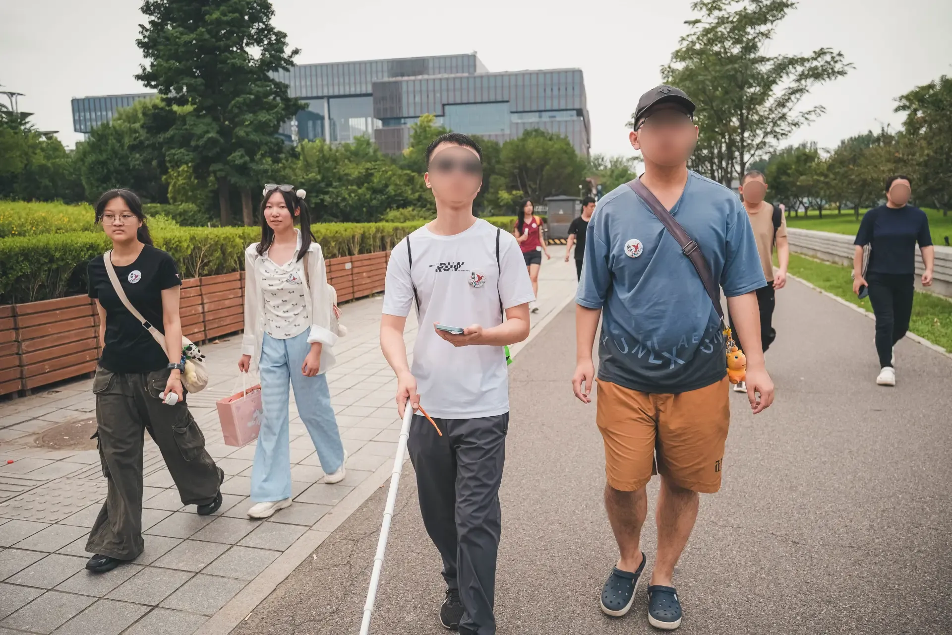
The team has also continued learning from offline activities. Orinav has worked with organizations including Hequn to observe navigation during outdoor activities involving people with visual impairments and sighted volunteers. These activities exposed challenges that appear less often on standardized research routes, including temporary construction, changes in entrance locations, and outdated map information. Such observations have guided later work on dynamic road conditions and the final segment of destination navigation.
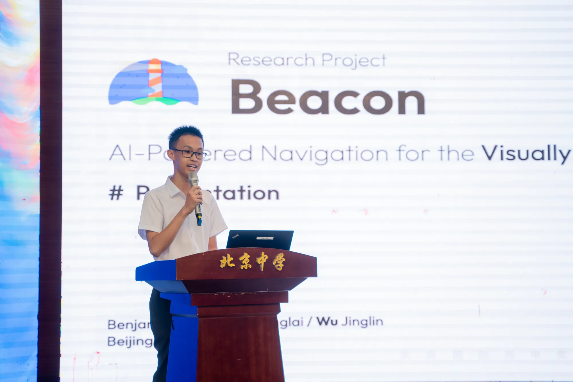
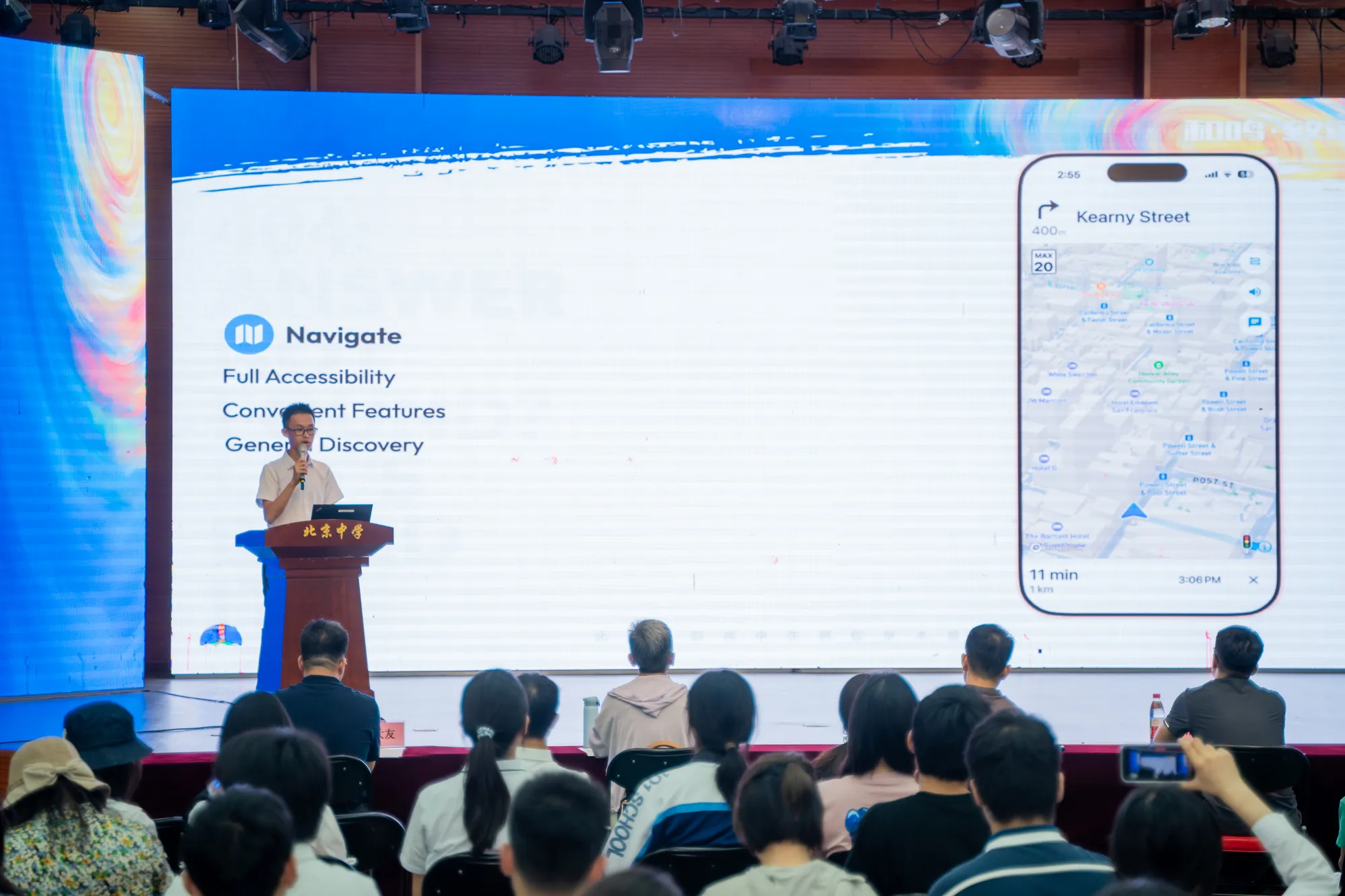
In 2025, Orinav was invited to present at Inclusive Innovations 2025, an accessibility technology event organized by Envision in the Netherlands. It was the project at the event developed by a high school student team. During the event, the team exchanged ideas with accessibility technology organizations and companies including Envision, TouchPulse, and Sensotec, receiving further feedback on product design and future collaboration. The project has also been presented at events including Beijing Academy's 12th Seminar on Building the Ideal School of the Future, introducing students and educators to assistive navigation technology and accessible design.

Orinav has received recognition through the Conrad Challenge China, accessibility programs at Tsinghua University, and other innovation activities. In 2026, the project received Highly Commended recognition in the Young Pioneer category of the AbilityNet Tech4Good Awards. Its development and research process has also been covered by The Beijing News and Beijing Radio and Television Station's Evening Express. The team has further documented the system design and field study in the research paper Orinav: A Hybrid Mobile Outdoor Navigation Application for People with Visual Impairments.




Project Outcomes and Future Development
From the first Beacon prototype to the current version of Orinav, the project has continued for nearly two years. Beginning with literature research and user interviews, the team gradually developed route navigation, environmental recognition, and accessible interaction features before evaluating the application on real streets. Data from the field study with 18 participants showed that Orinav reduced navigation time and hesitations while achieving substantially higher perceived usability. Feedback from users in multiple countries after the public release has continued to provide new information about everyday travel.
The next stage of development will focus on traffic light orientation, entrance recognition, and richer road environment information, while expanding field research to longer routes and more complex street conditions. Future studies will also include users with a wider range of visual conditions and navigation experience. At the same time, the project will continue working with organizations serving people with visual impairments, accessibility researchers, mapping and technology companies, and relevant public agencies to improve the accuracy and timeliness of navigation information.
Orinav will continue to develop from specific problems encountered by people with visual impairments during everyday travel and incorporate user feedback into each stage of development. As route data, environmental recognition, and accessible interaction continue to improve, the project aims to provide more people with clear and timely navigation information that fits their own travel habits.